How Far Is South Padre Island From Galveston

Last spring, I sat in a Galveston coffee shop while a friend unfolded a Texas map and announced we could “totally” drive to South Padre Island for lunch. He tapped the coast w...

Last spring, I sat in a Galveston coffee shop while a friend unfolded a Texas map and announced we could “totally” drive to South Padre Island for lunch. He tapped the coast with confidence. Then he measured the distance, and his face did that slow-motion collapse you see when someone realizes Texas is not a normal state.
That moment stuck with me, because “How far is South Padre Island from Galveston?” sounds simple. It isn’t. The answer depends on whether you mean straight-line distance or actual road miles, and those numbers tell very different stories.
The Short Answer: About 260 Miles as the Seagull Flies
If you draw a straight line from Galveston to South Padre Island, you get roughly 250 to 270 miles. That’s the number a bird, a drone, or a very optimistic map app might use. That’s the trap.
Must Read
On a map, the Texas Gulf Coast curves like a lazy smile. Galveston sits near the upper corner, while South Padre Island hangs at the very bottom, close to Brownsville and the Mexican border. The straight-line route cuts across bays, estuaries, and a whole lot of water. Unless you have wings, that number is mostly trivia.
By Car? More Like 400 Miles of Texas
Once you commit to driving, the distance jumps to roughly 400 to 420 miles. The exact number depends on your starting point on Galveston Island, your route, and how many times you reroute because someone says, “Let’s avoid Houston traffic.” In good conditions, that’s about 6.5 to 7.5 hours behind the wheel.
You’ll likely head north toward Houston or west toward San Antonio, then drop south through Corpus Christi and continue toward Brownsville. From there, you cross the Queen Isabella Causeway onto South Padre Island. It’s a proper road trip, not a quick coastal hop.
Why the Drive Feels Longer Than the Map Says
Texas has a way of making distance feel personal. You can drive for hours and still be in the same state, same coast, same endless stretch of taqueria billboards. The highway miles add up fast, and the scenery shifts from beach town to prairie to city sprawl and back again.
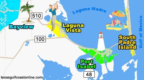 South Padre Island Texas - Texas Beach Homes
Also, South Padre Island isn’t just “on the coast.” It’s at the far southern tip of the Texas Gulf Coast. Galveston is near the upper-middle section. That vertical gap is the whole problem, and no amount of beach music can shrink it.
Route Options and Realistic Drive Times
One common route runs through Houston, then down US-59/I-69 toward Victoria and Corpus Christi. Another swings through San Antonio via I-10 and I-37 before connecting to US-77 south. Both are solid, and both will remind you that Texas is really, really big.
Leave Galveston at sunrise, and you might reach South Padre by mid-afternoon. Add a lunch stop, a bathroom break, or Houston rush hour, and you’re looking at a full day.
What About Flying or Boating?
Flying changes everything. A small plane could cover the straight-line distance in about an hour. Commercial flights usually mean connecting through Houston or Dallas, which can turn a short flight into a long day of airports.
 South Padre Island
Boating? Technically possible along the Gulf Coast, but not a casual afternoon sail. You’d need the right vessel, weather window, and a serious tolerance for open water.
So, Can You Do It as a Day Trip?
You can, but you probably shouldn’t. A day trip would mean roughly 13 to 15 hours of driving, plus whatever time you spend actually enjoying the beach. That’s a lot of windshield time for a few hours of sand.
If you’re determined, make it an overnight trip or a weekend. Stay in Galveston, leave early, and break up the drive in Corpus Christi or San Antonio. Your back, your bladder, and your travel companion will thank you.
The Bottom Line
South Padre Island is about 260 miles from Galveston as the seagull flies. By car, it’s more like 400 miles and a solid 7-hour drive. That’s the difference between a map fantasy and a Texas reality.
So the next time someone says it’s “just down the coast,” hand them a map. Then hand them a snack. They’re going to need both.
